Hydrogeological maps
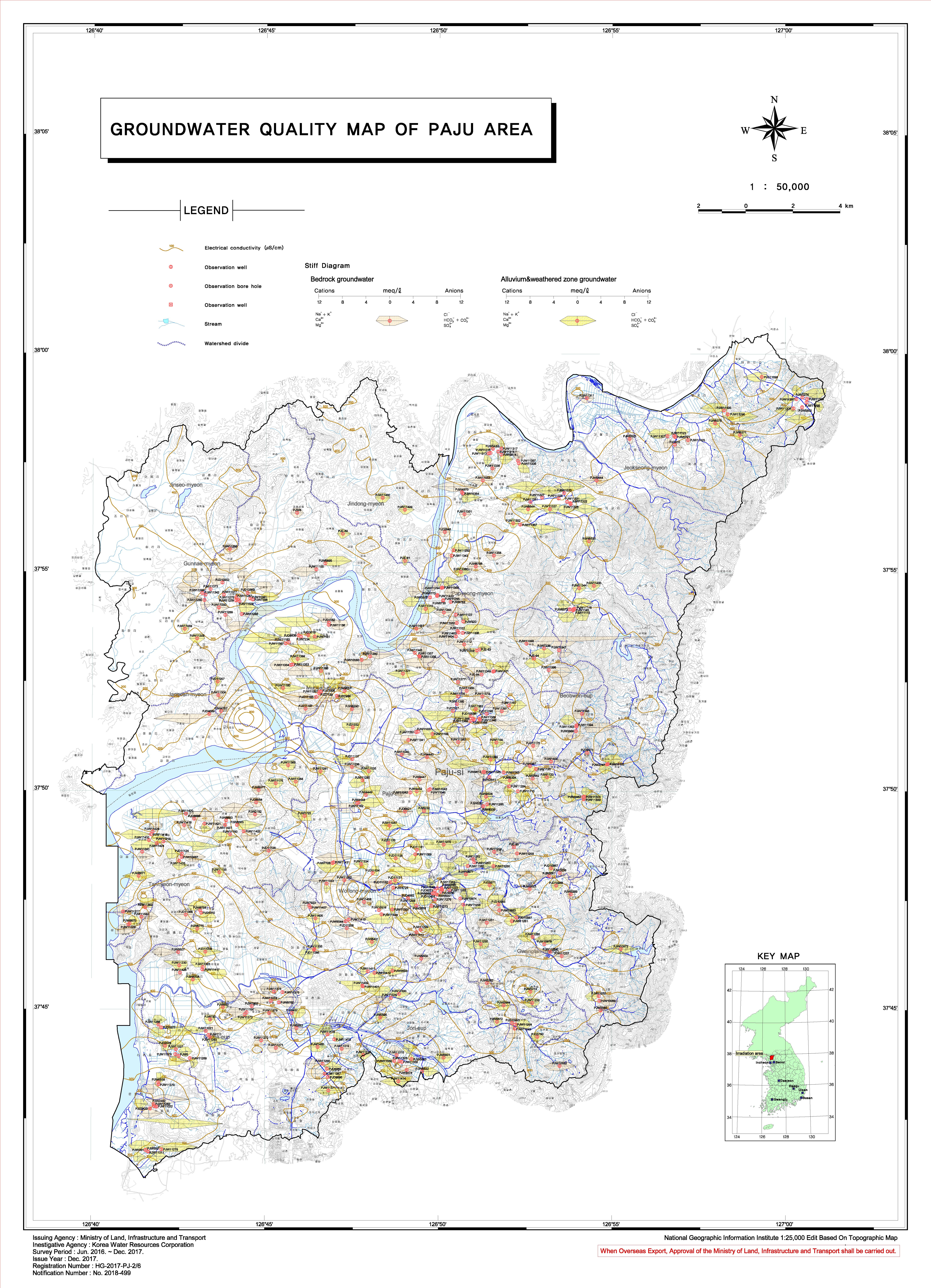
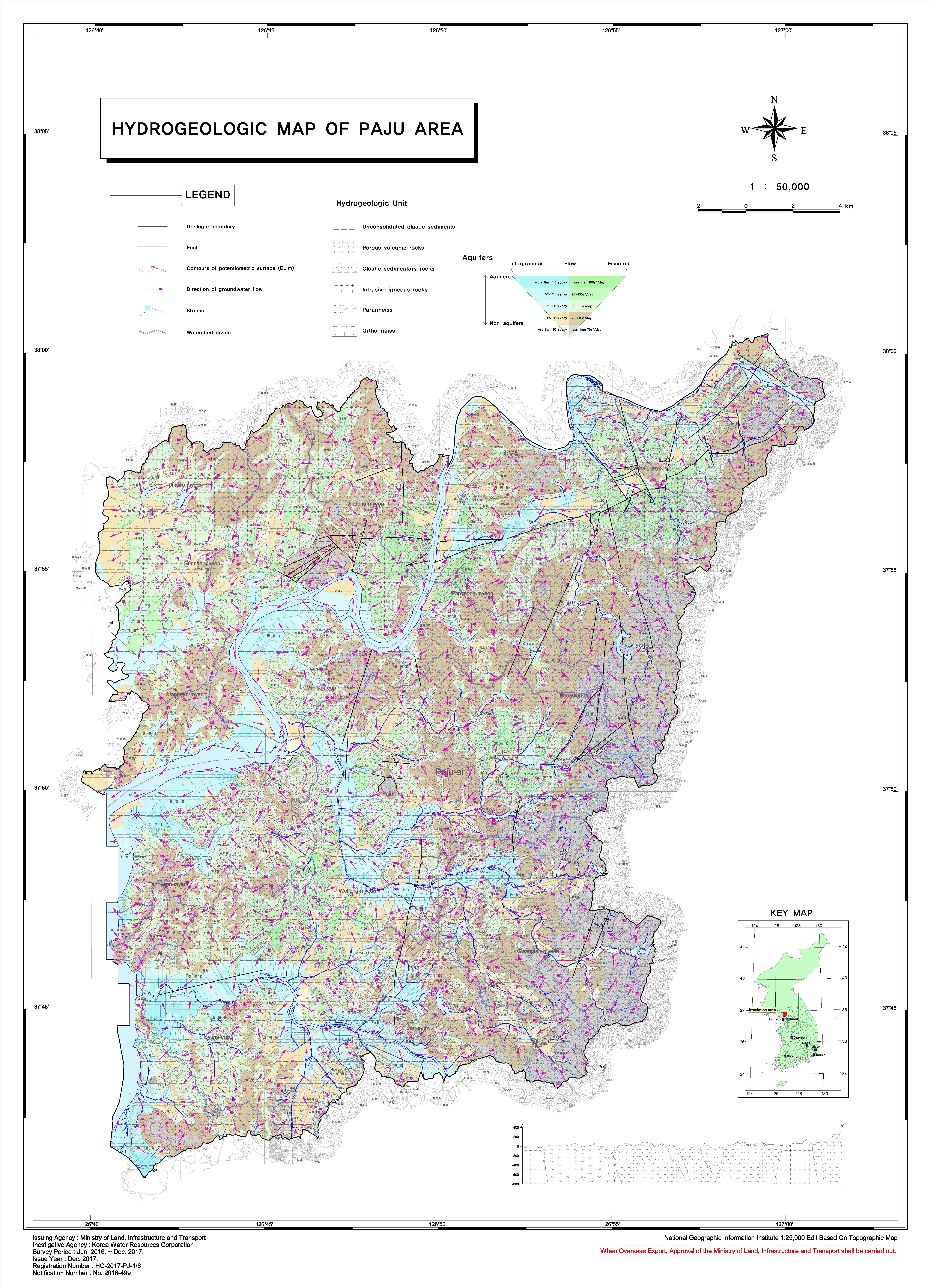
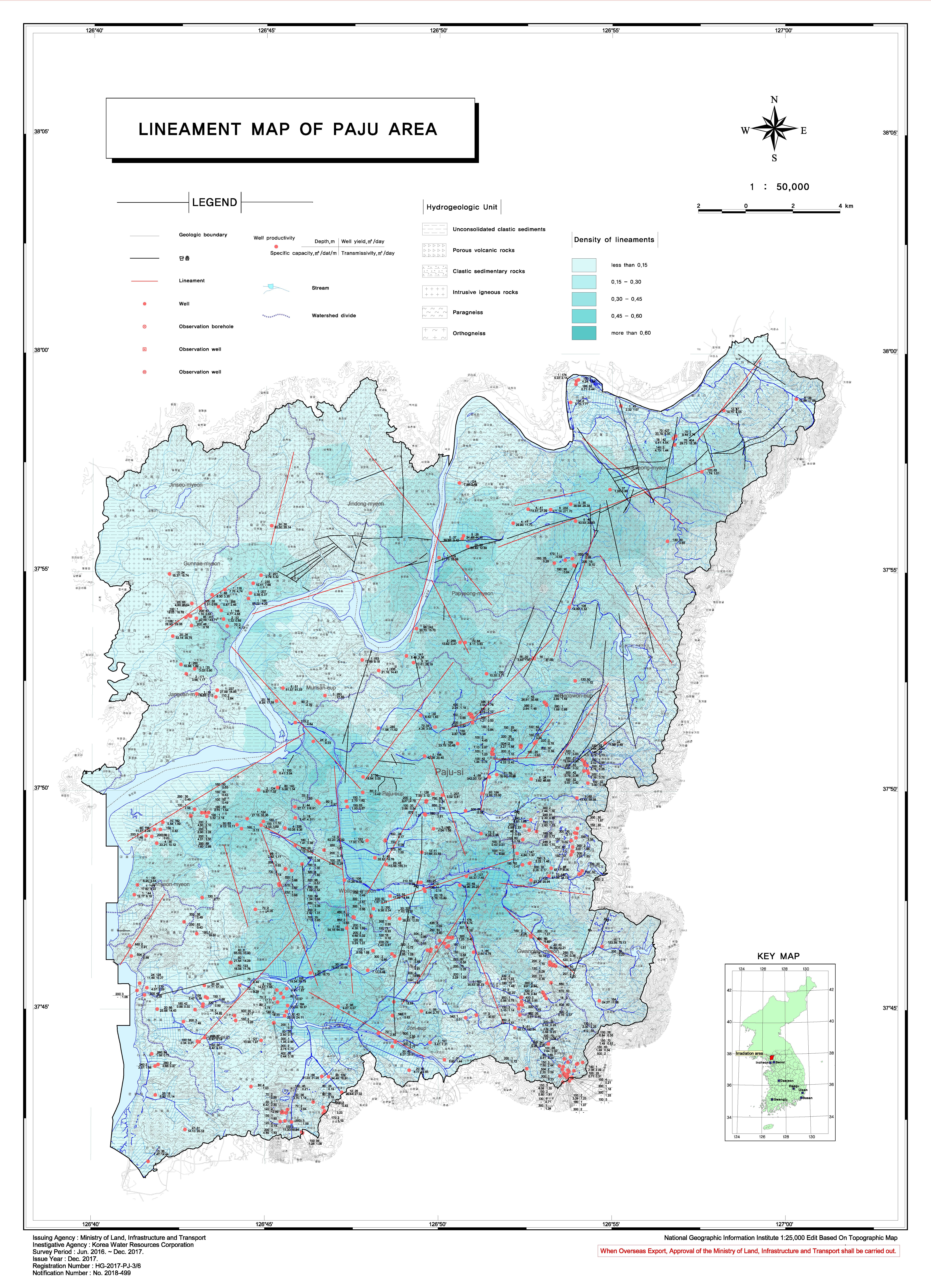
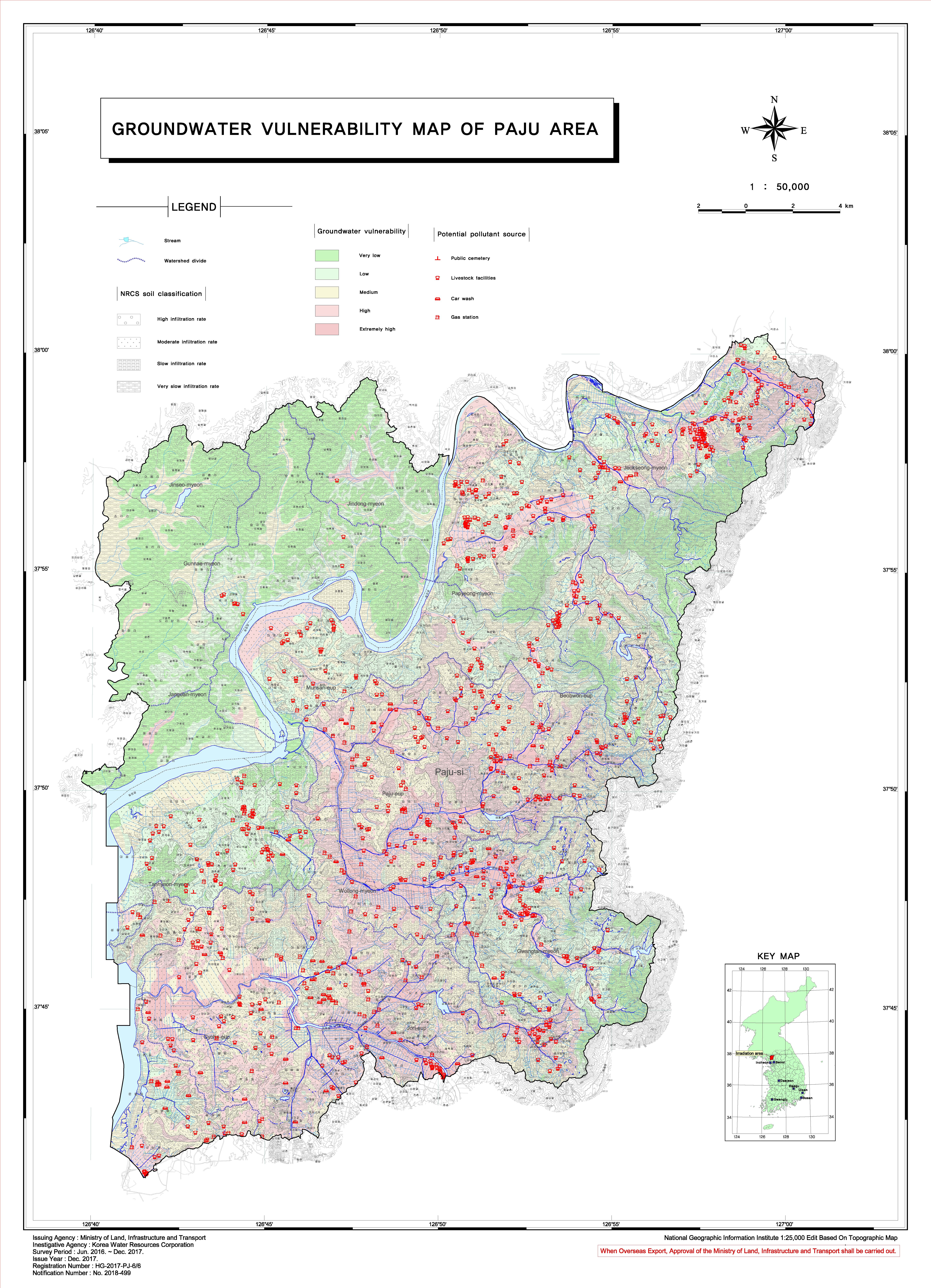
Hydrogeological maps are composed of 5~7 thematic maps, such as a main hydrogeologic, depth to water,
lineament, quality and vulnerability
K-water published "A standard for basic groundwater surveys and hydrogeological maps" includes a guide for
groundwater investigation methods, standards for hydrogeological map drawing and digitalization(map size, symbol, aquifer calssification, etc) in 2015
The main hydrogeological map
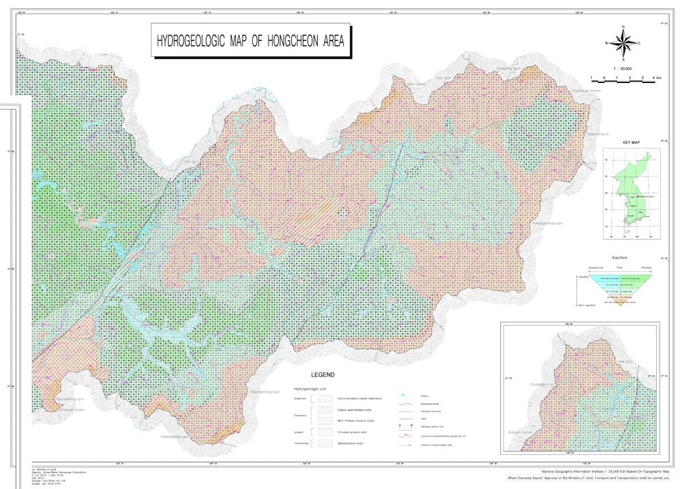
- Distinction of geological unit and geographical age
- Groundwater level, Contour water level, groundwater flaw direction
- Classification of aquifer and the amount of exploitable groundwater
Thermatic maps
- Current state chart of groundwater quality
- Vulnerability chart of groundwater contamination
- Distribution chart of linear structures
- Distribution chart of groundwater depth and etc.
Providing all the result of research to the related agency and the public through the internet (http://www.gims.co.kr)
Hydrogeological maps View
| City | Operator | Period of business | Area(㎢) | View |
|---|---|---|---|---|
| Seoul Special City | Seoul Special City | 1995.05~1996.12 | 606 | |
| Busan Metropolitan City | MOCT / K-Water | 2002.01~2003.12 | 758 | View |
| Daegu Metropolitan City | MOCT / K-Water | 2003.01~2004.12 | 886 | View |
| Incheon Metropolitan City | MOCT / K-Water | 2004.01~2005.12 | 959 | View |
| Gwangju Metropolitan City | MOCT / K-Water | 2004.01~2005.12 | 501 | View |
| Daejeon Metropolitan City | MOCT / K-Water | 2003.01~2004.12 | 540 | View |
| Ulsan Metropolitan City | MOCT / K-Water | 2003.01~2004.12 | 1,056 | View |
| Sejong Special City | MOCT / K-Water | 2005.01 ~ 2006.12 | 361 |
- Legal basis : Article 5 of the Groundwater Act
- The period : ~ 2021
- The conductor : MOLIT (an angency K-water)
- Investigation Area Unit : It is based on the administrative district unit, and if necessary, the map and the watershed are considered simultaneously.
- Investigation method :
- Focus on field research
- Including exploration, drilling, coaching
- Conduct observation survey
- Identify the details of each aquifer
- Collecting and analyzing existing data
- Focus on field research
- Survey period : 2 years by region
- Survey performance : Area groundwater map (1/50,000)
- Field of application :
- Utilization of groundwater exploration and development by region
- Proposed development, including possible points, the development available amount.
- Provide basic data upon groundwater permit review
- Applying to regional groundwater conservation management policies
- conservation area management needs, including proposed
- Utilization of groundwater exploration and development by region
- Survey Items
- Geology / Topography with field survey and Lineament interpretation
- Geophysical survey, Drilling and logging
- Recharge calculations and water budget
- Well inventory, Groundwater level and quality monitoring
- Pumping test, Modelling, Aquifer interpretation
- Contamination and quality interpretation
- Groundwater management plan, etc
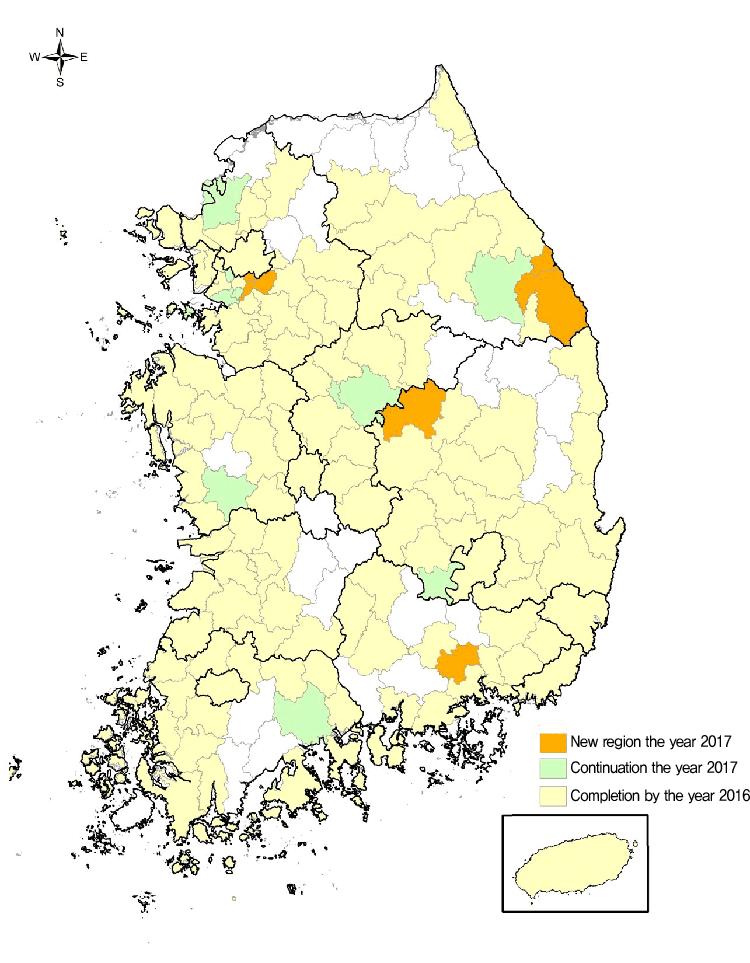
Survey Items Division Sum Completed
by 20162017 2018 - 2021 Si/Gun 167 119 17 31 Area (km²) 99,516 70,471 4,956 24,089 Map(Num) 147 107 7 33
Hydrogeological maps are composed of 5~7 thematic maps, such as a main hydrogeologic, depth to water,
lineament, quality and vulnerability
K-water published "A standard for basic groundwater surveys and hydrogeological maps" includes a guide for
groundwater investigation methods, standards for hydrogeological map drawing and digitalization(map size, symbol, aquifer calssification, etc) in 2003
The main hydrogeological map

- Distinction of geological unit and geographical age
- Groundwater level, Contour water level, groundwater flaw direction
- Classification of aquifer and the amount of exploitable groundwater
Thermatic maps
-
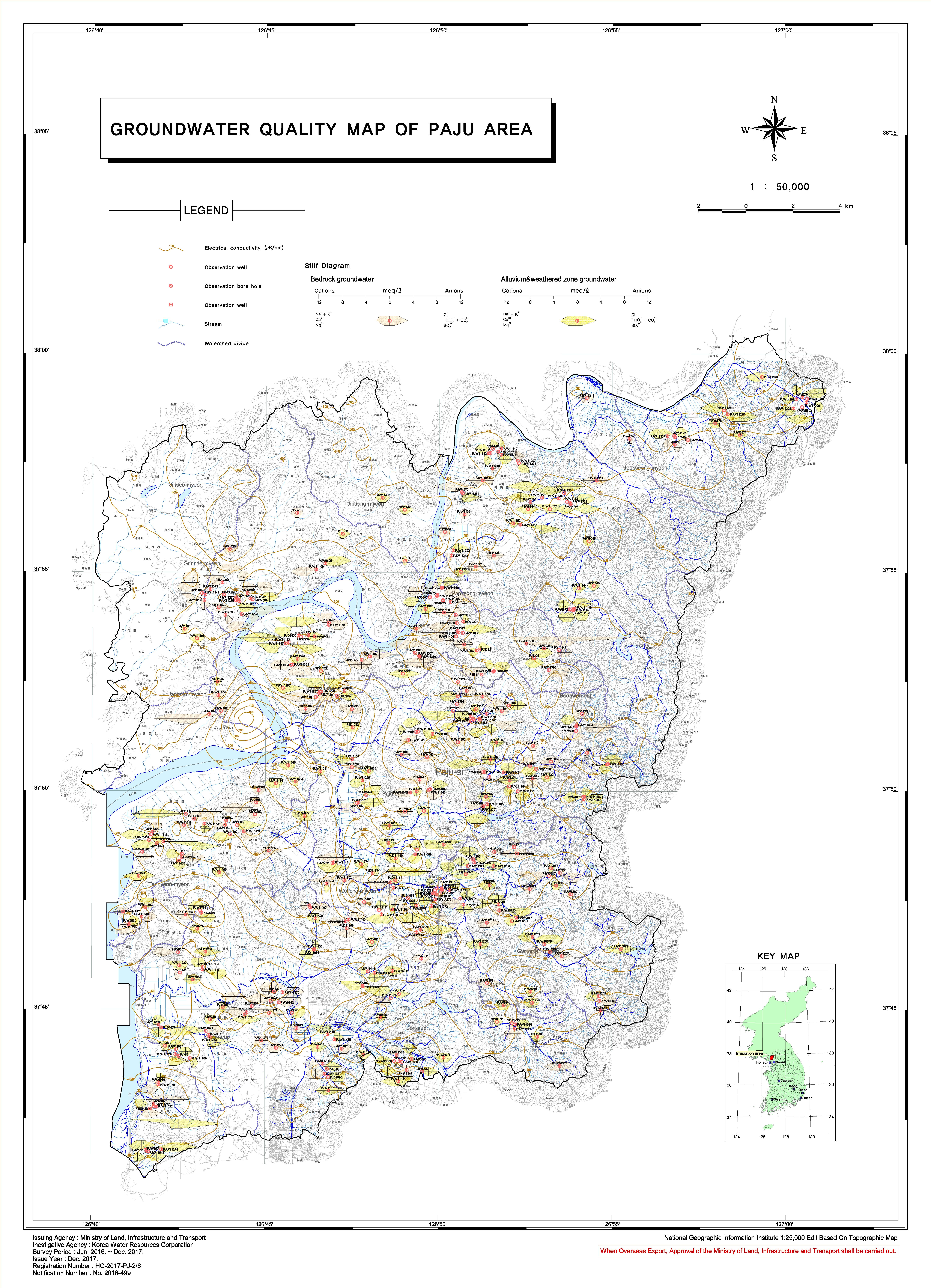
Groundwater Quality Map
-
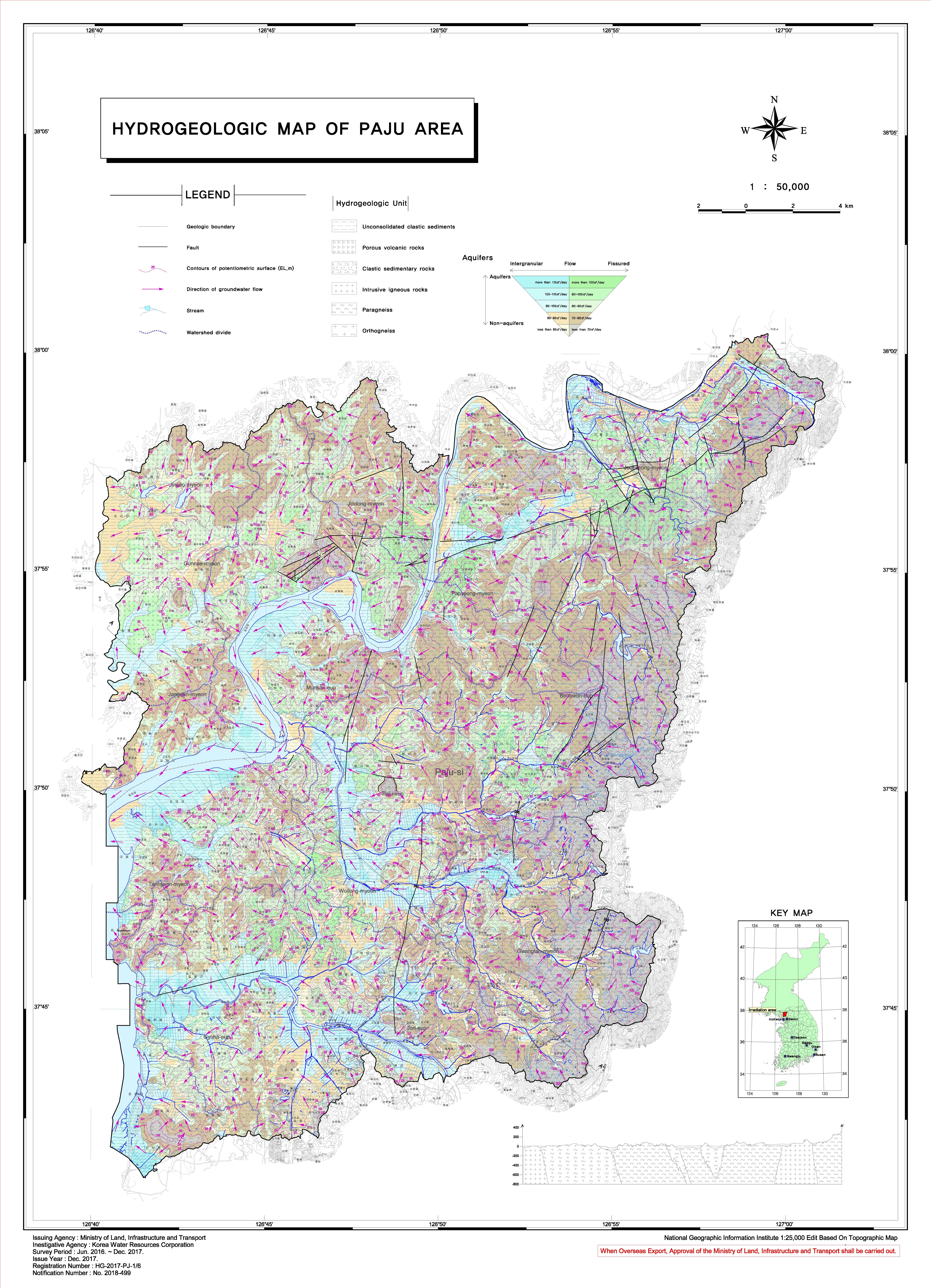
Hydrogeologic Map
-
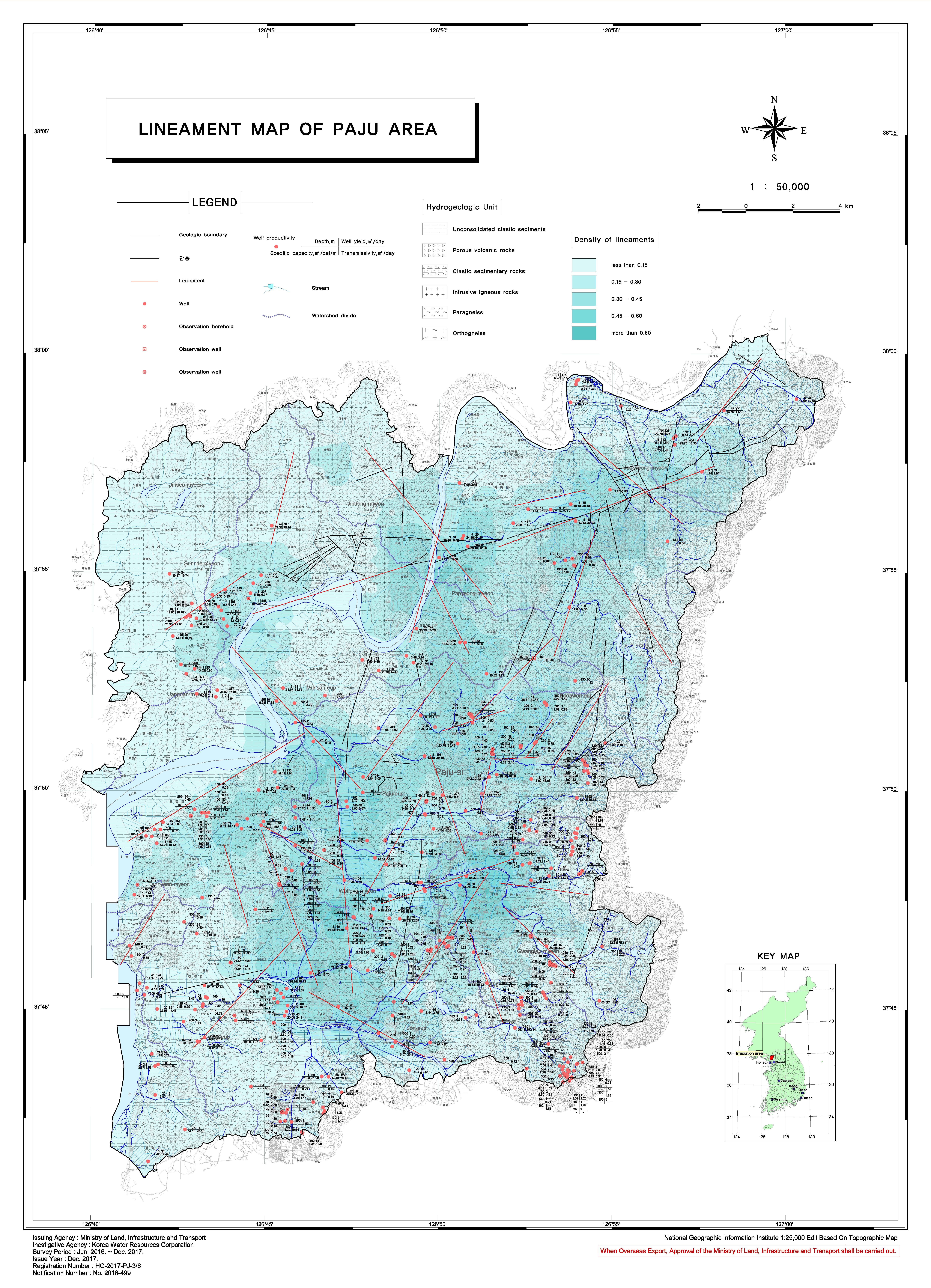
Lineament Map
-
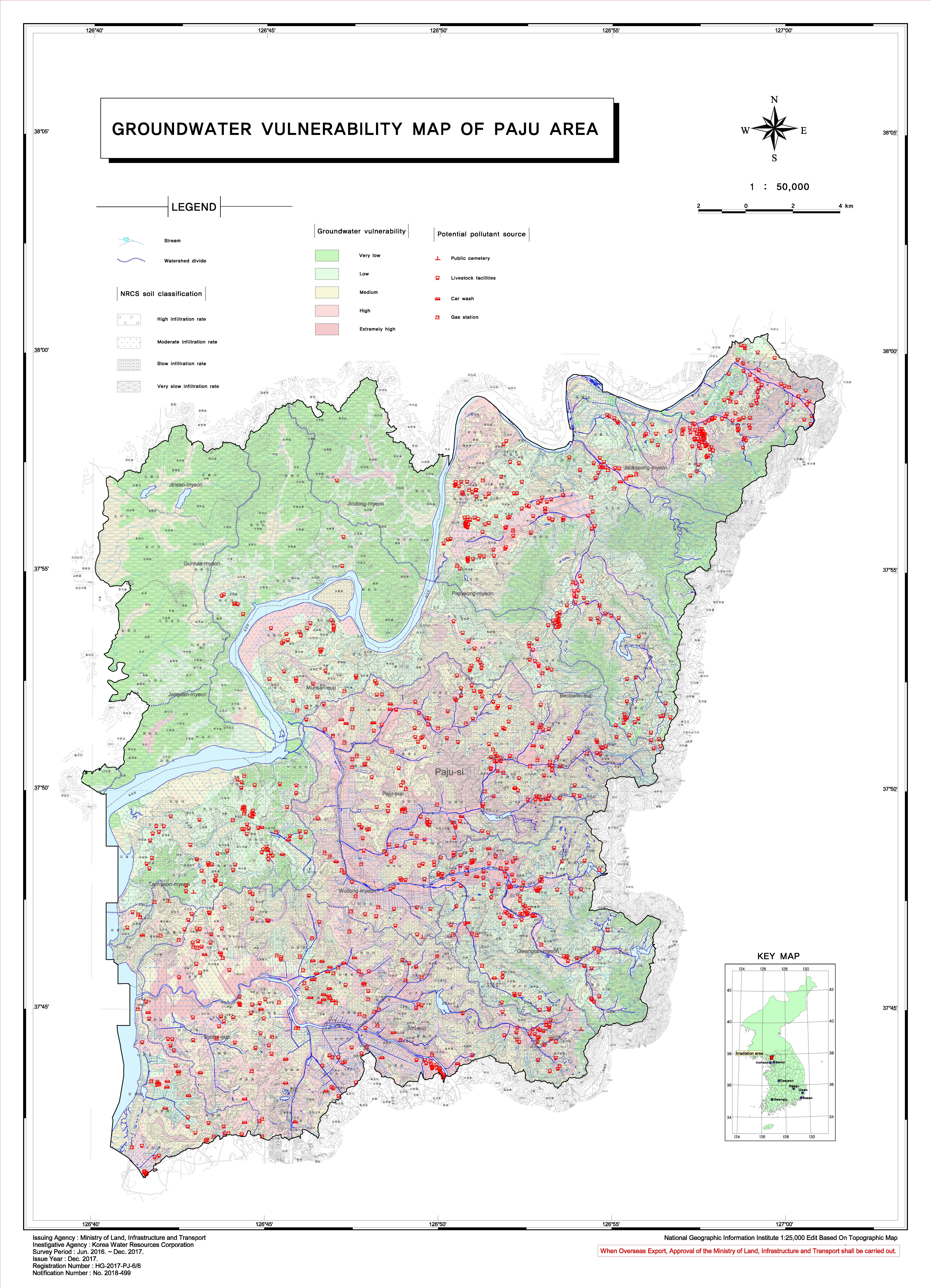
Groundwater Vulnerability Map
-
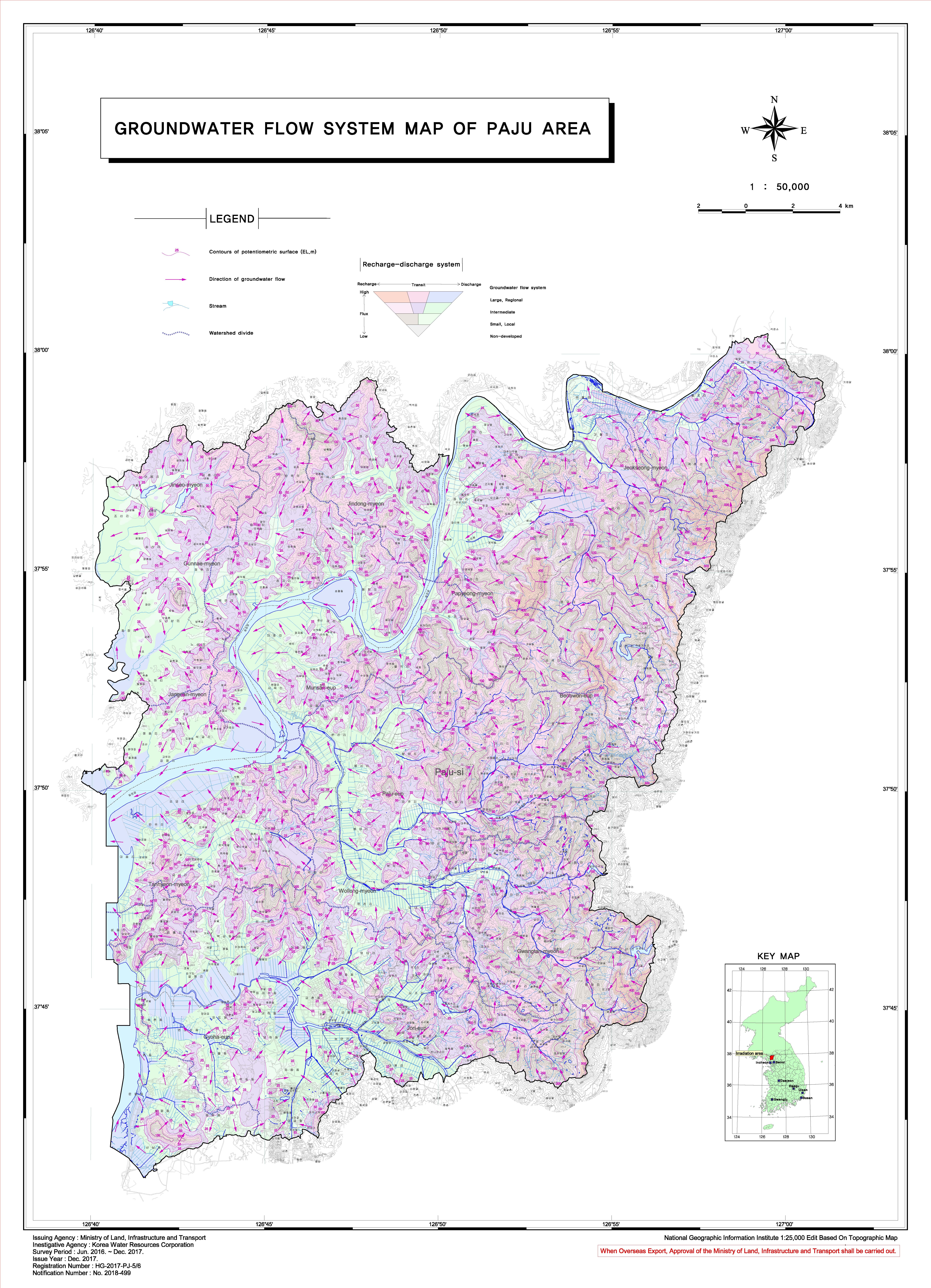
Groundwater Flow Systems Map
-
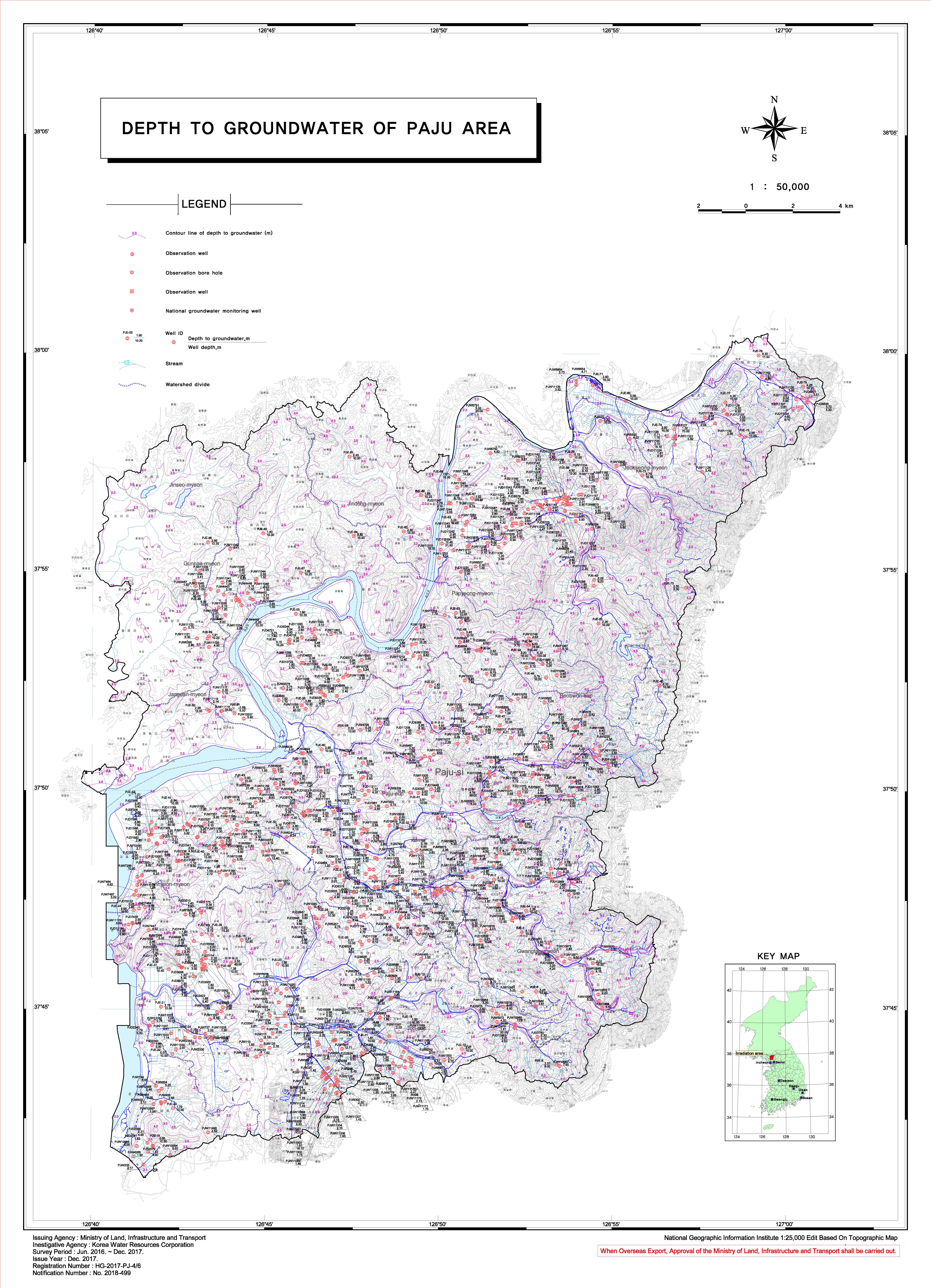
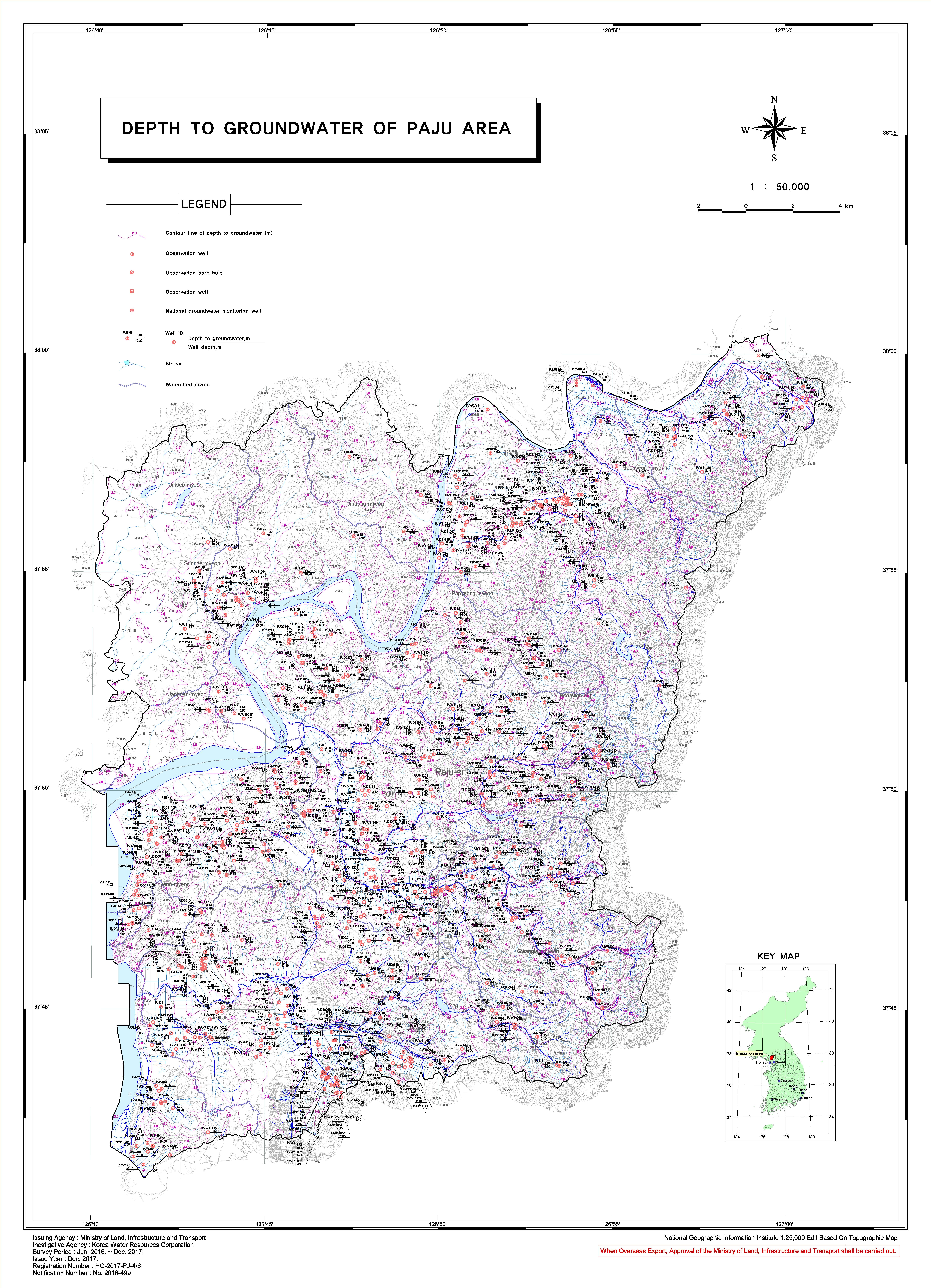
Depth To Groundwater Map
- Current state chart of groundwater quality
- Vulnerability chart of groundwater contamination
- Distribution chart of linear structures
- Distribution chart of groundwater depth and etc.
Providing all the result of research to the related agency and the public through the internet (http://www.gims.co.kr)
Hydrogeological maps View
| City | Operator | Period of business | Area(㎢) | View |
|---|---|---|---|---|
| Han River Basin | K-Water | 2004.06~2006.12 | 41,958 | View |
| Nakdong River Basin | K-Water | 1999.01~2000.12 | 31,776 | View |
| Keum River Basin | K-Water | 2001.04~2002.12 | 14,063 | View |
| Youngsan River-Seomjin River Basin | K-Water | 1997.09~1998.12 | 17,081 |
- Legal basis : Article 5 of the Groundwater Act
- The conductor : MOLIT (an angency K-water)
- Investigation Area Unit : Investigate nationwide which is divided into Geum River, Han River, Nakdong River and Seomjin-Youngsan River region.
- Investigation method :
- Focus on existing data collection and analysis
- Field research
- Observation Survey Period : 2 ~ 3 years for each region
- Survey performance : basin groundwater map (1/250,000)
- Field of application :
- Use as basic data for correction in supplementing groundwater management basic plan
- Selecting urgent areas for development use and conservation management, and presenting areas for groundwater survey by region


 ADDRESS : 200, Sintanjin-ro, Daedeok-gu, Daejeon 306-711 Korea/ T:82-42-629-4166 F:82-42-629-4175 Email:jwkim@kwater.or.kr